Exploration areas
The "Lutrina" exploration area

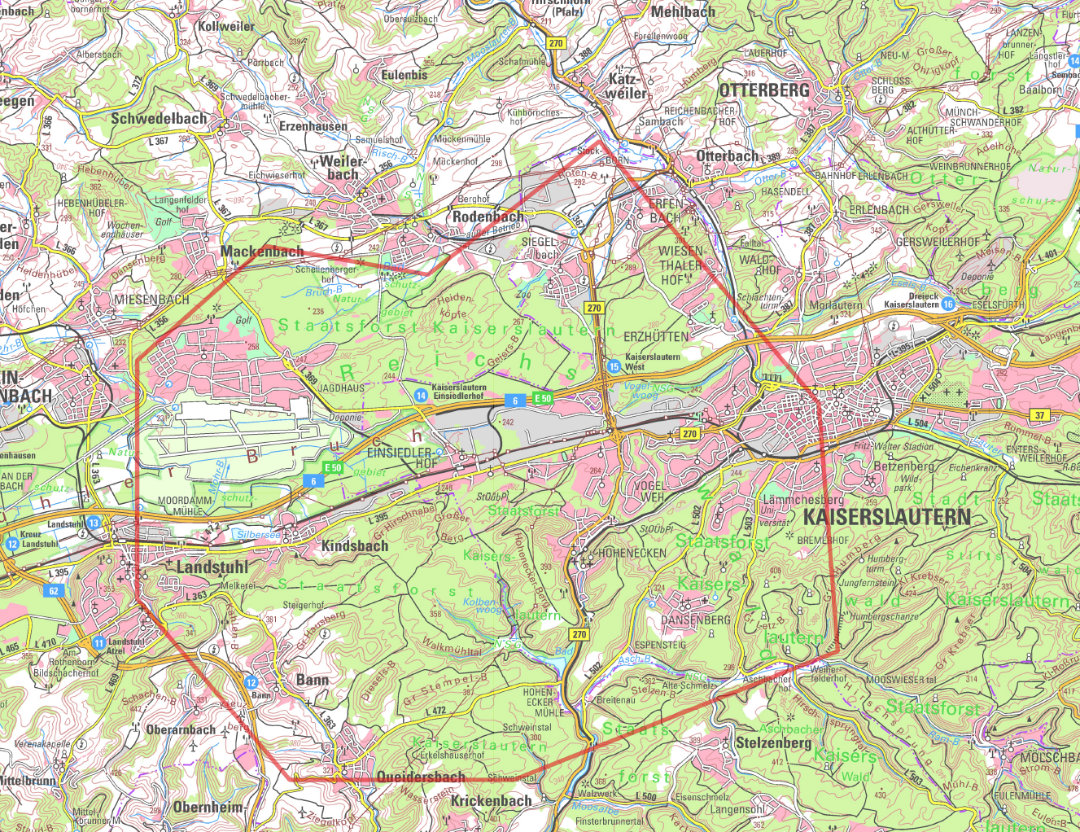
The 143 km2 “Lutrina” exploration area, named after the legendary founder of the city, covers the south-western part of the city of Kaiserslautern. The following municipalities are also included:
- Krickenbach
- Rodenbach
- Trippstadt
- Oberarnbach
- Landstuhl
- Weilerbach
- Queidersbach
- Ramstein-Miesenbach
- Kindsbach
- Otterbach
- Stelzenberg
- Bann
3D seismic exploration is planned to take place during the low-vegetation period from fall 2025 to spring 2026, spanning a period of approx. 6 weeks. The challenge is that the survey area includes nationally and internationally protected zones, such as biotopes or water protection areas, and the Ramstein Airbase. These sensitive areas have to be taken into account when planning the exploration.
The "Kasimir" exploration area
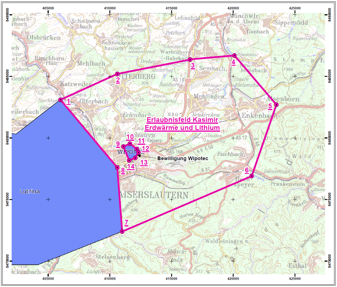
The “Kasimir” exploration area is adjacent to “Lutrina” one in the northwest. A special feature of this field is that it contains the exploration permit of the company Wipotec. The company for high-precision weighing technology and production control has been successfully using medium-depth geothermal energy to generate heat in this area for several years. Seismic exploration in “Kasimir” exploration area is not yet in the concrete planning stage, as the neighbouring exploration area “Lutrina” has been started first. Nevertheless, it makes sense to keep the field in municipal hands, especially given the interest from private-sector project developers.

