
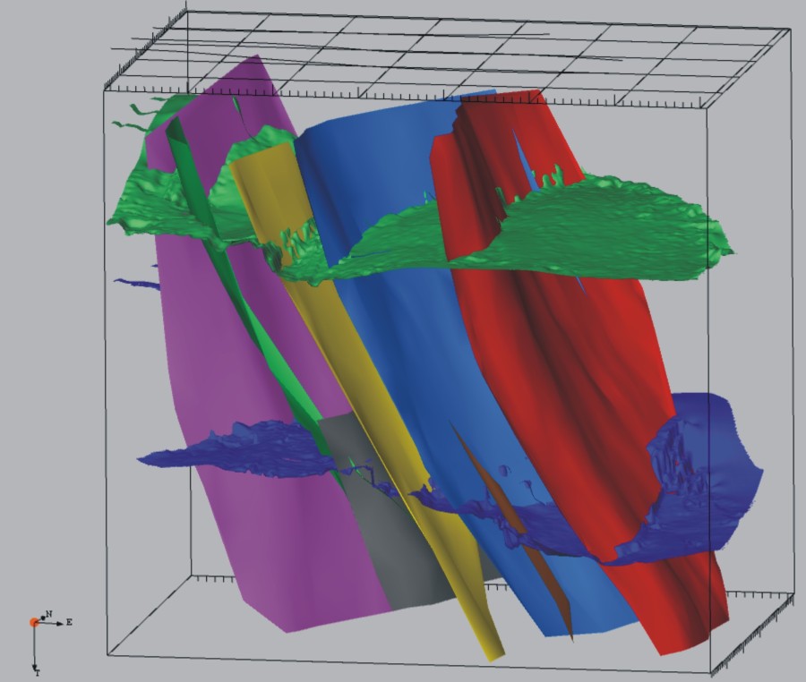
Modellhafte Auswertung der 3D-Seismik-Daten in Weinheim (Baden-Württemberg)
© 360plus Consult
Image of the subsoil
As part of the exploration work in the ‘Lutrina’ licence area, so-called 3D seismic surveying is being used. This technique, which is comparable to an ultrasound scan, enables the creation of an image of the subsurface that shows the boundaries between rock layers and fault zones. The data obtained can, for example, be combined with information from boreholes and analysed to produce a three-dimensional representation. In addition to providing general insights, the results can be used to identify future drilling targets.

So-called vibro-trucks are used for the seismic measurements; these travel in convoy along a pre-planned grid.
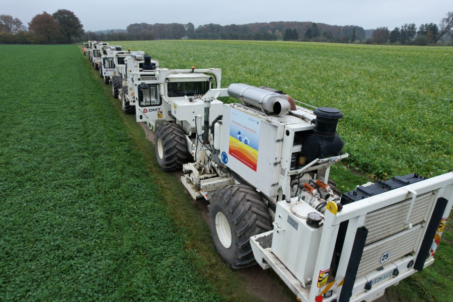
Vibro-Trucks auf einer Messstrecke in Nordrhein-Westfalen.
© Vladimir Shipilin
The Seismic Trucks
- 3 to 5 vibro-trucks, each weighing 20–30 tonnes
- Stops every 20–40 metres
- At each stop: vibrate 2–4 times for approx. 10–100 seconds
The vibro-trucks are fitted with metal vibratory plates which are lowered onto the ground at each stop, causing it to vibrate. The sound waves penetrate the subsurface and are reflected along the boundaries between rock layers and fault zones. The reflected signals can then be recorded using geophones on the surface.
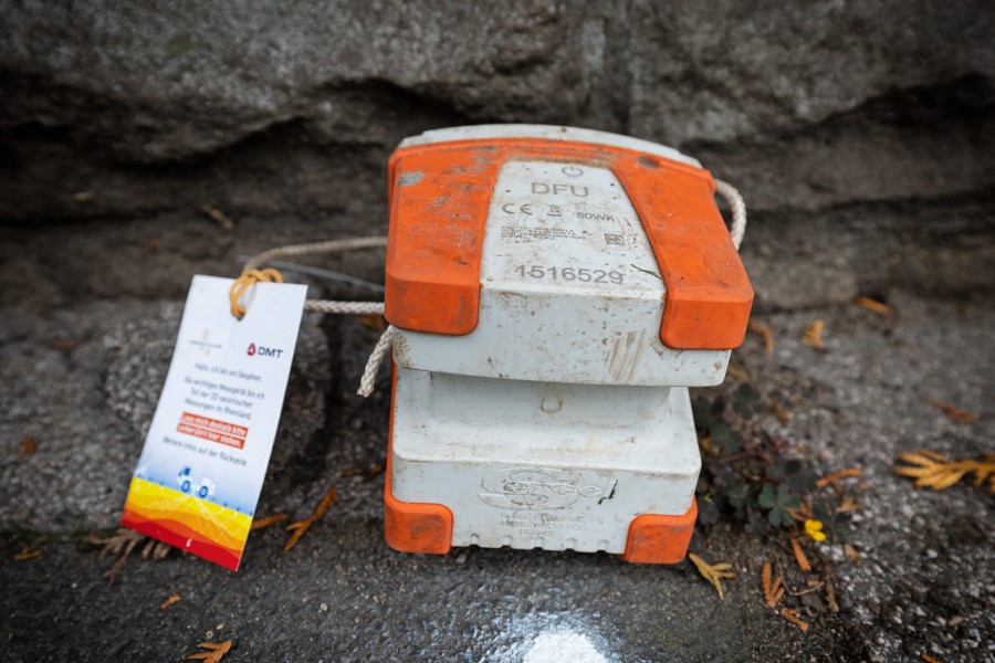
Geophon mit „Geophon-Anhänger“, welcher über die Messungen informiert und Vorbeikommende bittet, die Geräte an ihrem Platz stehen zu lassen
© Karl-Heinz Frings
The geophones
Geophones are highly sensitive measuring devices, roughly the size of a loaf of bread. They are positioned in a grid pattern across the survey area and record the reflected signals sent into the ground by the vibro-trucks. These signals are converted into analogue signals whilst still inside the geophone and then stored. Once the measurements are complete, the geophones are collected, the data is downloaded and analysed by experts.
If you see any geophones, please leave them where they are. Each individual measuring device is an important source of data for subsequent analysis. If you find any geophones in unusual locations, we would be grateful if you could let us know briefly by emailing lutrina@ips-celle.de.
Impact on the surrounding area
Although 3D seismic surveys are a low-impact method, they do have an impact on the immediate surroundings. For example, due to the convoy’s slow speed, traffic restrictions may apply, comparable to those at a mobile roadworks site. Despite the sound insulation of the vibro-trucks and compliance with all applicable guidelines, residents living along the survey route will also experience significant noise disturbance for approximately one to two hours.
Although directed towards the subsurface, the vibrations generated can also be felt in the immediate vicinity of the seismic trucks. The sensation is comparable to a tingling under the soles of the feet, similar to that felt when a tram passes by, for example. To prevent damage to local infrastructure, such as roads or buildings, the vibrations are kept below a specified upper limit. The DIN 4150 standard for vibrations in the construction industry sets out binding requirements for how the effects of vibrations on buildings are to be measured and assessed. Normally, damage to buildings can be ruled out for vibration velocities of up to five millimetres per second. Compliance with the guideline values is monitored by means of separate measurements taken directly on the adjacent buildings. Should damage nevertheless occur, the so-called reversal of the burden of proof under the Federal Mining Act applies. The surveying company – or we, Stadtwerke Kaiserslautern, as their client – must therefore be able to prove that the damage was NOT caused by us.
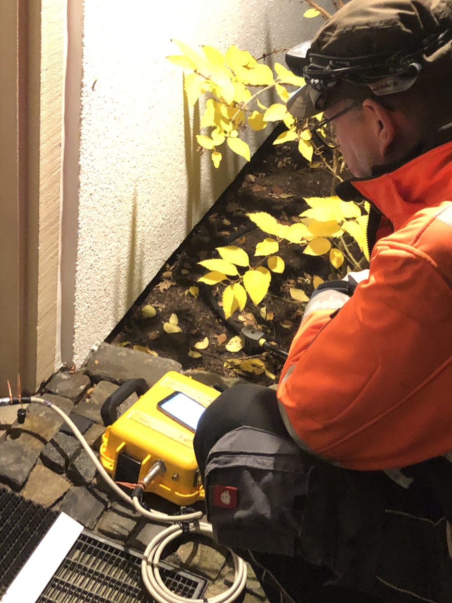
Kontrollmessungen an einem Wohngebäude entlang der seismischen Messlinie.
© Ingo Schäfer